
Hydrographic Projects
Hydrographic Survey Projects
Hydrographic Surveying Projects Conducted in the San Francisco
Bay Area and California.
Project: Sacramento Emergency Levee Repair
Client:
City of Redwood City
Location: Redwood City, CA
Description: Hydrographic surveying for the existing conditions survey of the Redwood Shores Lagoon System. The base map for the dredging is based on the Meridian Surveying Engineering, Inc. pre-design survey from 2005. Dredging Surveys conducted in 2010.
Project: Carmel River Lagoon
Client:
RMC Water and Environment
Location: Carmel, CA
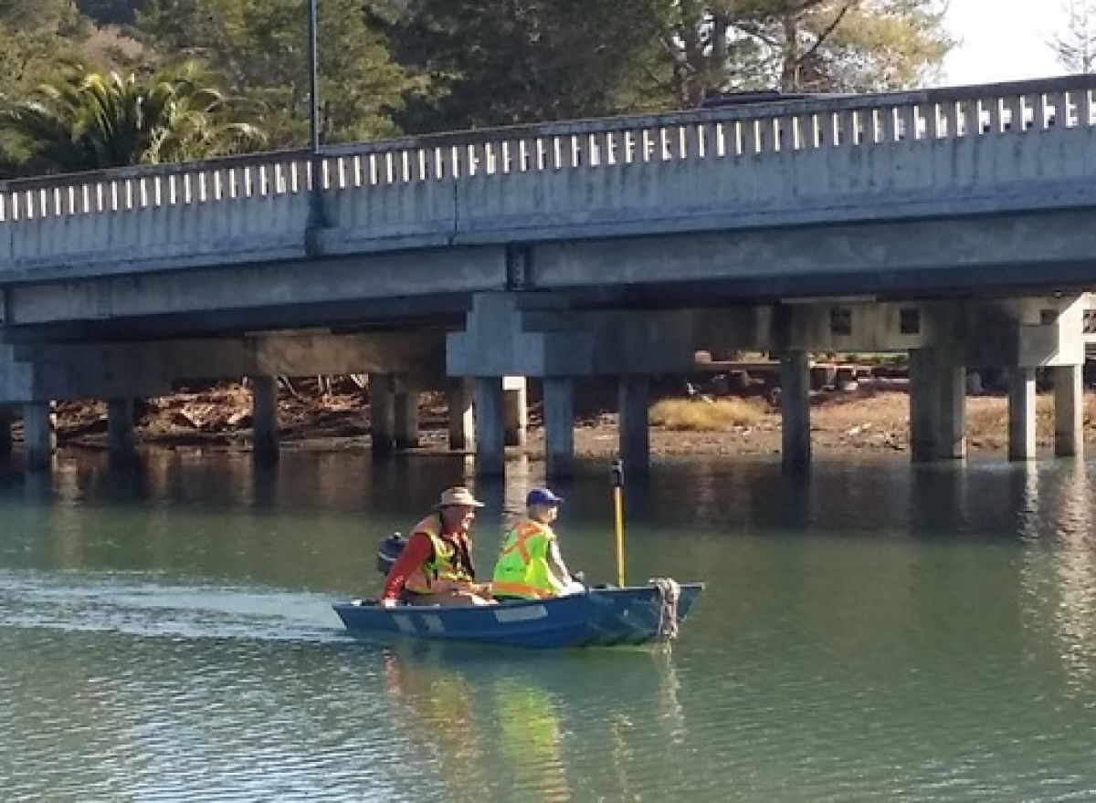
Description: A Class-1 bathymetric survey was performed of this environmentally sensitive area utilizing a combination of hydrographic, RTK, robotics and new aerial photography.
Project: Emeryville Marina
Client:
Emeryville Marina, LLC
Location: Emeryville, CA
Description: MSE, INC conducted a Class 1 bathymetric pre and post dredge survey of the Marina to help with Marina redesign efforts
Project: County of Marin Paradise Cay Hydrographic Survey
Client:
River Construction
Location: Tiburon, CA
Description: MSE, INC conducted a Class 1 bathymetric pre-dredge survey of the Marina to help with Marina redesign efforts and future dredging needs. Hydrographic surveying for the County of Marin Dredging project CSA-29 under supervision of the County Flood Department.
Project: Delta Levee Repair
Client:
Siegfried Engineering, July 2008
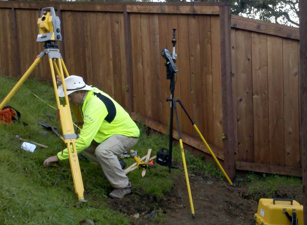
Description: Description: Delta levee repair project where Meridian worked directly with another land surveying firm to create contours that included both land survey and hydrographic survey data. Both projects required Meridian’s variety of tools, including real-time kinematic GPS, single beam echosounder, robotic total stations, a shallow water aluminum boat, a 17′ riverboat, 4-wheel drive trucks, and more. Hypack and AutoCAD Land Desktop were used for post processing and mapping.
Project: Marina West Basin Maintenance
Client:
Vortex Marine Construction, Inc.
Description: Description: Pre and Post Dredge surveying for Vortex Marine Construction, Inc. in support of the dredging operation. Meridian Surveying Engineering, Inc. also assisted in setting up the GPS interface for the machine control on the bucket dredger
Project: Sausalito Marina
Client:
Private owner
Location: Marin County, CA
Description: MSE, INC conducted a Class 1 bathymetric pre-dredge survey of the Marina to help with Marina planning and redesign.
Project: Oyster Point
Client:
URS Corporation
Location: San Mateo County, CA
Description: Bathymetric monitoring program established for environmentally sensitive concrete cap with regular monitoring and reporting.
Project: Petaluma River
Client:
Black and Veatch
Location: Sonoma County, CA
Description: Class-1 Bathymetric Survey of the Petaluma River integrated into their Surface Water Master Plan.
Project: San Mateo-Hayward Bridge Seismic Retrofit
Client:
General Construction Company, Seattle Washington
Location: San Francisco Bay, CA
Description: Class-1 pre-construction bathymetric survey and conditions mapping.
Project: Emergency Delta Levee Repair Hydrographic Survey
Client:
URS Corporation, October 2006
Description: This mapping effort was contracted by the URS Corporation for their work with the Department of Water Resources, Emergency Levee Repairs. The project required a quick response time due to the anticipated rainstorms of winter. We successfully completed the project on time.
Project: Hunters Point Pier Demolition, 2011
Client:
CKY, Inc (US Navy)
Description: Meridian Surveying Engineering, Inc. provided a signal beam hydrographic survey of all the docking bays at the Hunters Point Naval Shipyard. Also in support of the pier demolition; a magnetometer and a multi-beam survey where provided to insure the safety of the demolition plan. At the end of 2011 the same survey will be conducted to insure the pier are removed and not disposed of in the San Francisco Bay.
Project: PGE Crane Valley Dam 2011
Client:
Parsons Engineering
Description: Meridian Surveying Engineering, Inc. provided a signal beam hydrographic survey of the Crane Valley Dam (Bass Lake) for the dam’s safety modifications
Project: Carmel River
Project: Union Valley Reservoir in the High Sierra
More Surveying Services


additional services
RESIDENTIAL SURVEYING.
Specializing in Residential since 1989 – Boundary, Easements, Disputes, no project too small – extensive historical records…
HYDROGRAPHIC SURVEYING
Meridian Surveying Engineering Inc. is a full service hydrographic / bathymetric surveying firm…
H3D – HD LASER SCANNING
3D laser scanning is a new way of performing surveys that allows for the creation of accurate…
COMMERCIAL SURVEYING
We have done extensive work on Schools, Parks, Bridges, Tunnels, Commercial, Industrial, Machine & Crane Alignment…
CLAIMS LITIGATION SURVEYOR
MSE, INC provides on-going Expert Witness, Litigation Support and Mediation Services…
CLIENT TESTIMONIALS
“We will not hesitate to highly recommend your company to any of our clients…
Experienced, Responsive, Professional Land Surveyors Serving California and the San Francisco Bay Area. We are a CA State Certified Small Business Enterprise (SBE) and a City of San Francisco Certified Local Business Enterprise (LBE). Licensed Surveying Engineers. Meridian Survey offers, Commercial Surveys, (Alta, Lending, Finance and Refi Surveying), Drone Surveys, FEMA Elevation Certificates, Hydrographic Surveys and HD 3D Scanning Surveys. Our principal, Mr. Gray, also often serves as an Expert Witness Surveyor in the San Francisco Bay Area and Marin County. A few of our other specialties include Settlement Monitoring Surveys (for buildings) and SFP Approved Surveys (SFO Airport) and we are also an SF LBE/SBE Surveying firm.