
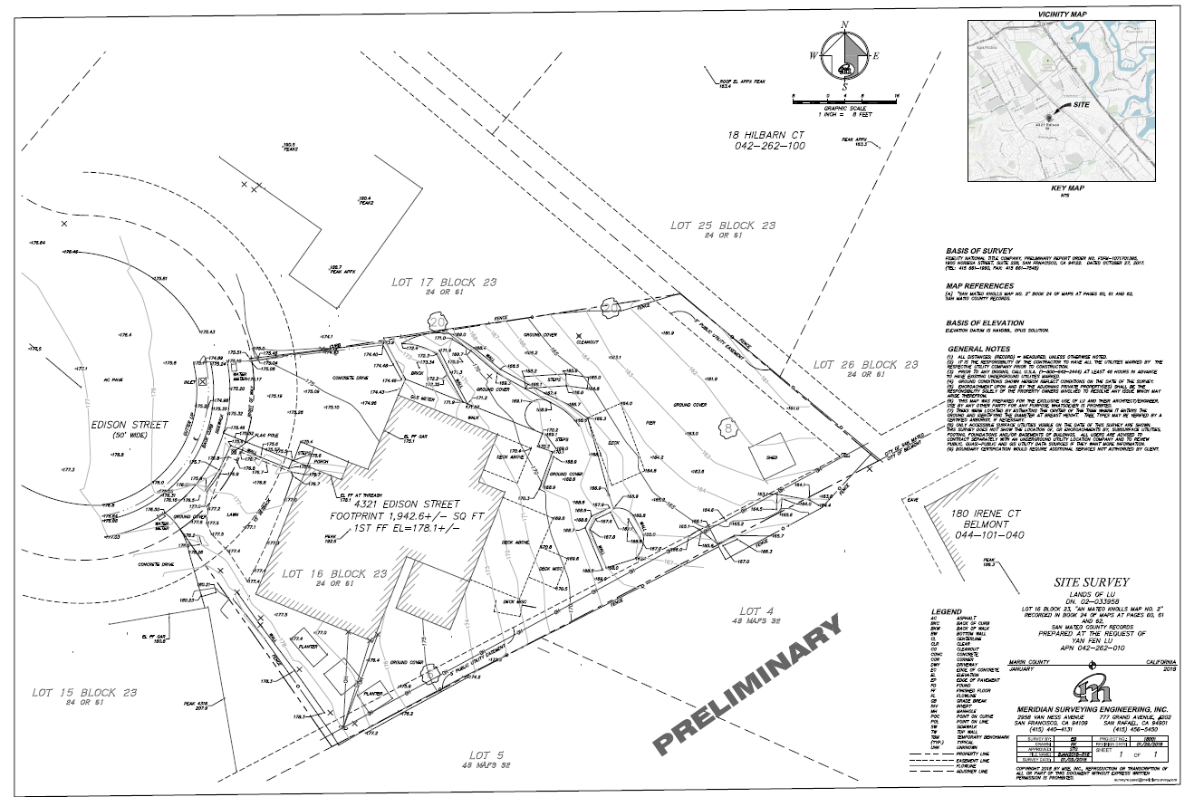
Topographic Surveys
All Services Create Topographic Maps
Topographic Surveys
All the services listed create topographic maps whether its from the air by plane, drone, satellite imagery, underwater using hydrographic/bathymetric techniques or on the surface using robotic total stations or HD 3d scanners. Pick your service and let us know how we can assist you.

More Surveying Services


Land surveyor
Surveying Since 1989
Experienced, Responsive, Professional Land Surveyors Serving California and the San Francisco Bay Area since 1982
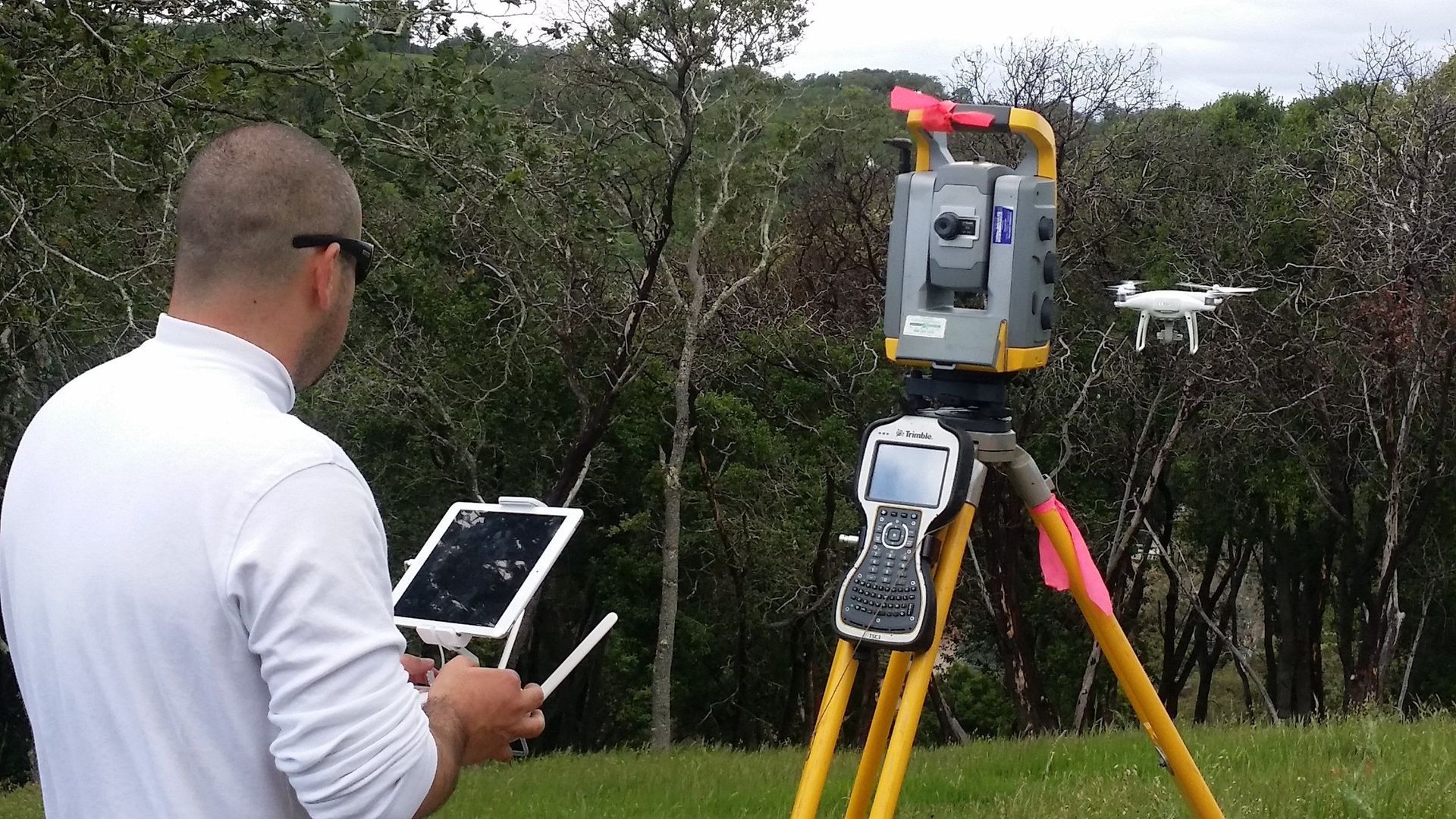
Meridian Surveying Engineering, Inc., provides professional surveying, planning and engineering support services to Municipalities, Contractors, Developers, A/E firms, Utilities and homeowners. Since 1982, Meridian and RGA have provided services in strategically located offices in the Cow Hollow area of San Francisco, Central San Rafael & Sacramento Delta / Antioch areas to better serve the San Francisco Bay Area. Meridian has a large array of state of the art equipment and can recommend and provide clients with the ideal tool for any survey project, land air or sea. Meridians services are scalable and we are capable of handling both large and small scale jobs. Our turnaround time for job completion is among the best in the industry. Our staff has extensive experience and a diverse educational background in Surveying Engineering, Industrial Engineering, Geology, Geography, Mathematics and GIS with related specialties. Whether you need to locate a fence in your backyard or need a hydrographic survey or an array of services for a large construction project, Meridian’s services will prove to be both timely and effective.
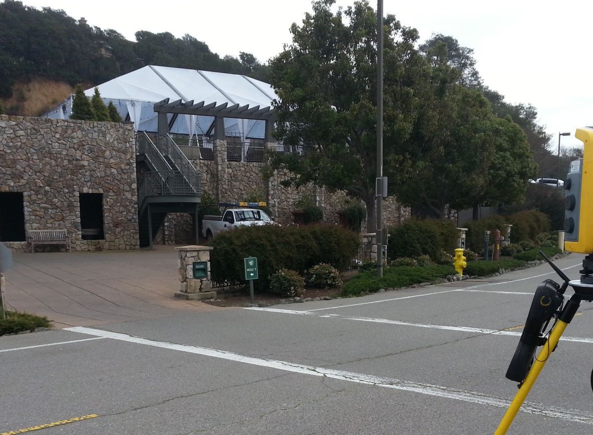
Commercial Surveying
We have done extensive work on Schools, Parks, Bridges, Tunnels, Commercial High Rise, Roads, and large scale Utility infrastructure projects. Commercial Surveyors for San Francisco bay area and California
- ALTA Surveys
- Subdivisions
- GIS Team Member
- Construction Staking
- Settlement Monitoring
- Subdivisions
- ADA Surveys
- Hazmat Certified
- Monitoring
- Precision Alignment
- Machine Control
- Feasibility Studies
- GPS
- Trimble GPS
- Spatial Imaging using 3D Scanning for Building Information Modeling (BIM)
Residential Surveying
We have done extensive work on Schools, Parks, Bridges, Tunnels, Commercial High Rise, Roads, and large scale Utility infrastructure projects. Commercial Surveyors for San Francisco bay area and California
- FEMA Elevation Certificates/Flood Certificates
- Site Plan Surveys
- Topographic Surveys/Site Surveys
- Easements
- Lot Line Adjustments
- Boundary (Property Line) Surveys
- Legal Descriptions
- Lot Line Adjustments
- Story Pole Certification
- View Corridors
- Redtag
- Parcel Maps