
Drone Surveyor
FAA Certified Pilot
Bay Area Drone Surveyor

ACCURACY REQUIREMENTS FAA CERTIFICATION
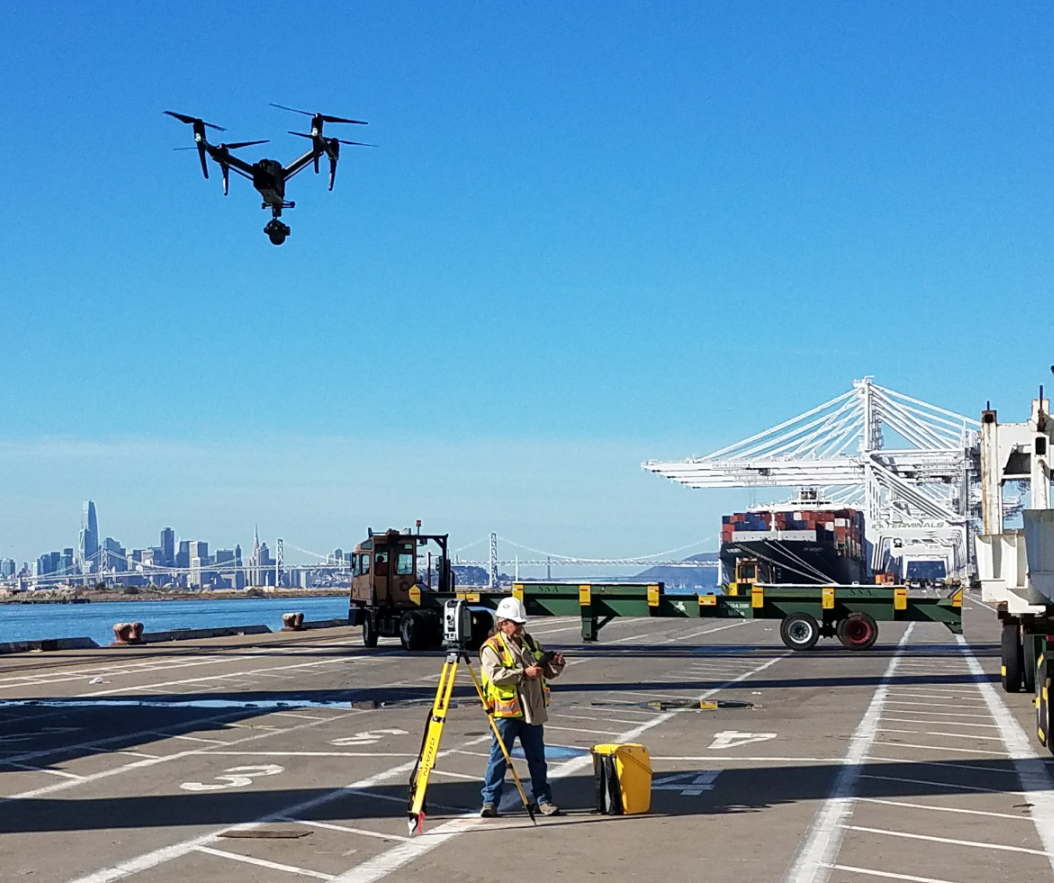
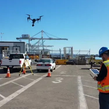
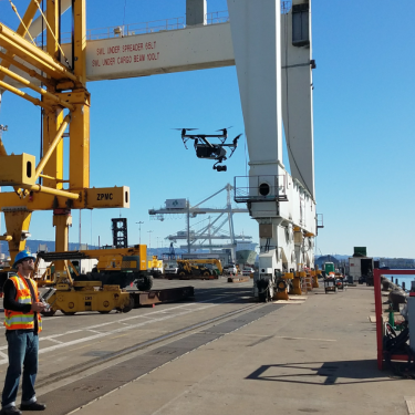
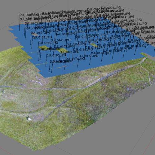
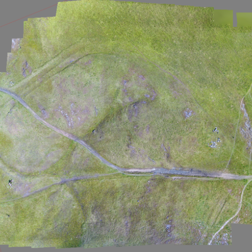
Meridian works with your team to clearly define deliverables and accuracy requirements for the mission at hand Mr Gray has a BS In Surveying and Photogrammetry, as well as extensive experience from projects domestically and abroad. With this expertise we can recommend and implement the correct technology to meet project requirements, including the use of Unmanned Aerial Vehicles (UAVs) or drones to quickly and accurately collect site data.
FAA CERTIFICATION
Our FAA certified drone pilot has experience piloting unmanned aircraft over urban and rural sites around the world. Meridian has worked extensively throughout California, and abroad, utilizing both conventional photogrammetry techniques, as well as LiDAR for the City of San Francisco and the Oban Beach Resort in Saipan. Past projects have included commercial apartment complexes, reservoir modeling linked to hydrographic, FERC transmission line surveys, as well as commercial plants and developments. To ensure professional grade results, true GNSS GPS is utilized for aerial control on the ground to guarantee precision accuracy.

More Survey Services


Useful Links
RESIDENTIAL SURVEYING.
Specializing in Residential since 1989 – Boundary, Easements, Disputes, no project too small – extensive historical records.
HYDROGRAPHIC SURVEYING
Meridian Surveying Engineering Inc. is a full service hydrographic / bathymetric surveying firm
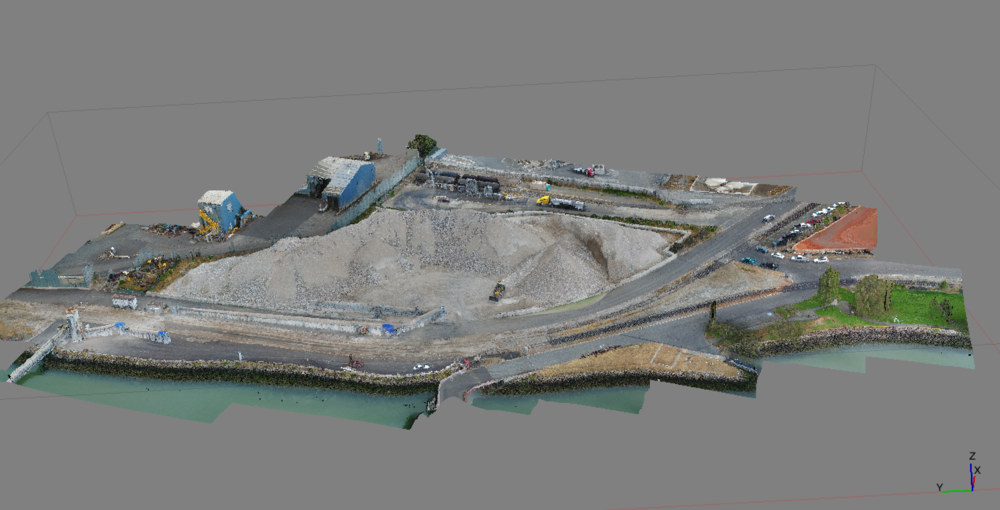
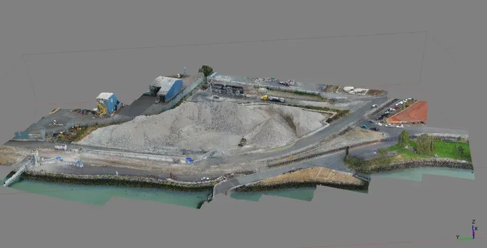
3D – HD LASER SCANNING
3D laser scanning is a new way of performing surveys that allows for the creation of accurate.
COMMERCIAL SURVEYING
We have done extensive work on Schools, Parks, Bridges, Tunnels, Commercial, Industrial, Machine & Crane Alignment…
CLAIMS LITIGATION SURVEYOR
MSE, INC provides on-going Expert Witness, Litigation Support and Mediation Services.
CLIENT TESTIMONIALS
“We will not hesitate to highly recommend your company to any of our clients.
Experienced, Responsive, Professional Land Surveyors Serving California and the San Francisco Bay Area. We are a CA State Certified Small Business Enterprise (SBE) and a City of San Francisco Certified Local Business Enterprise (LBE). Licensed Surveying Engineers. Meridian Survey offers, Commercial Surveys, (Alta, Lending, Finance and Refi Surveying), Drone Surveys, FEMA Elevation Certificates, Hydrographic Surveys and HD 3D Scanning Surveys. Our principal Mr. Gray also often serves as an Expert Witness Surveyor in the San Francisco Bay Area and Marin County. A few of our other specialties include: Settlement Monitoring Surveys (for buildings), SFP Approved Suryeys (SFO Airport) and we are also an SF LBE/SBE Surveying firm.
- Offices Near You
- Ready to Mobilize Crew
- Real Estate Surveyor
- Land Surveyor
- Civil Engineer
- Civil Engineering Company